Meteorológiai társalgó
Hasznos linkek (és egy infó)
TMAX TIPPVERSENY eredmények >> Sat24 műholdképek
>> Sat24 Magyarország mozgó műholdkép
>> Magyarországi radarképek archívuma
>>Tippelek az előrejelzési verseny aktuális fordulójában!
>>Rádiószondás felszállások élő követése!
>>Észlelés (közeli villámlás, jégeső, viharos szél, villámárvíz, szupercella, tuba, porördög, tornádó, víztölcsér, viharkár) beküldése a szupercella.hu-nak!
----------
Képek beillesztése esetén kérjük azokat megvágni, reklámok, mobilok fejléce, stb. csak feleslegesen foglalja a helyet és áttekinthetetlenné teszi az oldalt - a vágatlan képek ezért törlésre kerülnek.
Fotózáskor kérjük a mobilt fektetve használni, egy keskeny de magas kép egyrészt szintén sok helyet foglal, másrészt a kép sem túl élvezetes.
Köszönjük az együttműködést és a megértést.

Ja tévedtem mégis.  Az ENS alapján készül a leírás szerint.
Extended-range forecasts
The extended-range forecast provide an overview of the forecast for the coming month, focusing mainly on the week-to-week changes in the weather.
The charts generally present the forecast in terms of anomalies relative to climate (for example showing if the weather is likely to be warmer or colder than average for the time of year), and are mainly shown as 7-day means (for calendar weeks Monday-Sunday). They are derived from the ENS which is extended twice a week (on Thursday and Monday) to run to 32 days ahead instead of the usual 15 days.
As with the medium-range forecasts, specialised products for the extended-range include information on the potential tropical cyclone activity in the coming month. An important source of predictability on the monthly time scale is the Madden-Julian Oscillation (MJO), characterized by an eastward propagation of convection in the tropics, typically initiated over the Indian Ocean. We have specific products to monitor and forecast MJO activity.
Az ENS alapján készül a leírás szerint.Extended-range forecasts
The extended-range forecast provide an overview of the forecast for the coming month, focusing mainly on the week-to-week changes in the weather.
The charts generally present the forecast in terms of anomalies relative to climate (for example showing if the weather is likely to be warmer or colder than average for the time of year), and are mainly shown as 7-day means (for calendar weeks Monday-Sunday). They are derived from the ENS which is extended twice a week (on Thursday and Monday) to run to 32 days ahead instead of the usual 15 days.
As with the medium-range forecasts, specialised products for the extended-range include information on the potential tropical cyclone activity in the coming month. An important source of predictability on the monthly time scale is the Madden-Julian Oscillation (MJO), characterized by an eastward propagation of convection in the tropics, typically initiated over the Indian Ocean. We have specific products to monitor and forecast MJO activity.
Utolsó észlelés
Térképek
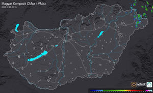
Radar
Aktuális hõmérséklet
Aktuális szél
Utolsó kép

Érdekességek | 2026-07-02 11:26
Szabályzat